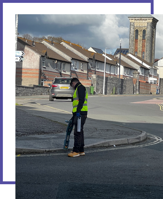
If you require premium topographical surveys in London, you’ve come to the right place. We are Ambler Group – your trusted partner for topographical surveys in London. We deliver fast, reliable, and tailored topographical surveys in London. With a range of services, including topographical surveys in London and GPR surveys, we help you minimise risks and optimise efficiency. So, if you’re looking for personalised guidance and premium topographical surveys in London, contact us today.
Request a free quotation
Fill this form to get your free quotation from our experts – enquire today to lock in your quote for our Ambler Group SURVEYS

What is a topographical survey?
Our topographical surveys in London are comprehensive studies that gather data about the shape and features of the land surface, both natural and man-made. Topographical surveys in London involve capturing detailed information about the terrain, including elevations and contours. These surveys are conducted for various purposes and outputs, such as accurate site visualization and development planning.
Why do I need a topographical survey?
Topographical surveys in London conducted using total stations are crucial for a wide range of projects, including land development, road construction, building construction, and environmental projects. By providing valuable information about the terrain and features, topographical surveys in London help avoid costly issues, optimise designs, and ensure successful project execution.

How are topographical surveys done?
We complete our topographical surveys in London in several steps. Here’s how we undertake our topographical surveys in London…
Equipment
Topographical surveys in London involve the use of high-tech equipment, including GPS devices, total stations, and 3D scanners. With this equipment, our topographical surveys in London will gather accurate and precise information about the terrain and features present in the surveyed area.
Measurements
Our surveyors set up the total station at strategic locations within the survey area, ensuring that known reference points are used for calibration. Using the total station, surveyors measure both angles and distances to various points of interest, such as buildings, utilities, and natural features. The data collected from topographical surveys in London is then stored in electronic format, facilitating further analysis and processing.
Detailed Drawings
One of the key advantages of our topographical surveys in London is the ability to create detailed CAD drawings, contour maps, and terrain models. These outputs provide architects and engineers with accurate representations of the surveyed area, allowing for precise design and construction planning.
Data
The resulting data from our topographical surveys in London is often referenced to a national grid coordinate system, ensuring alignment with other mapping products and geographic datasets. This aspect enhances the survey’s integration with various other projects and ensures seamless data compatibility.
Topographical Surveys in London | Frequently Asked Questions
Q1: Why are topographical surveys important?
A: Our topographical surveys in London provide data for land development, project planning, infrastructure design, and environmental assessments. By providing valuable information about the terrain and features, topographical surveys in London help avoid costly issues, optimise designs, and ensure successful project execution.
Q2: What is the difference between a topographical survey and a land survey?
A: Our topographical surveys in London map the surface features and terrain of a piece of land. Land (or boundary) surveys focus on property boundaries, lines and legal property descriptions.
Q3: Where are topographical surveys used?
A: Some applications of our topographical surveys in London are:
- Site planning for construction projects.
- Drainage planning.
- Environmental impact assessments.
- Land development planning.
- Infrastructure design.
Q4: Do I need a topographical survey for planning?
A: When planning to extend or change your home, topographical surveys in London may be worthwhile. Building on the land surrounding your home could present some challenges without topographical surveys in London.
Q5: How much do topographical surveys in London cost?
A: The cost of our topographical surveys in London will vary depending on your requirements. Please don’t hesitate to contact us today for more information.
Q6: How long do topographical surveys in London take?
A: The length of time our topographical surveys in London take will vary depending on your requirements. Please don’t hesitate to contact us today for more information.

Need a service & ready to book? Call us 01403 756 116
Our Related Services…
Utility Surveys in London
Our utility surveys in London are conducted to find all services within an area. Also known as utility mapping or a utility locating survey, this process identifies underground utility lines and infrastructure. Our utility surveys in London can find water, gas pipes, electric (HV and LV), communications (BT, CATV various others) traffic signals, fuel lines, drainage and heating pipes.
Why choose Ambler Group for your topographical surveys in London?
1
Experience & Excellence
We are leaders in topographical surveys in London. Boasting specialist knowledge, continuous development, and unparalleled service, we love what we do, and our clients can feel that passion in every interaction.
2
Affordable Surveys
We’re committed to offering topographical surveys in London that you can afford. We don’t think our services should break the bank, so don’t hesitate to get in touch with us for affordable topographical surveys in London.
3
Friendly Team
We’re all about building strong connections and relationships with our team, clients, and other surveying professionals across the UK. Whether we’re out on-site or just chatting in the office, our mission shines through.
If you’re looking for reliable, premium topographical surveys in London, contact us today!
